UNSW Canberra Oceanographers track floating objects to original location
Submitted by Julie on
UNSW Canberra Oceanographers led by Associate Professor Xiao Hua Wang, Director of The Sino-Australian Research Consortium for Coastal Management, are tracking the paths of identified floating objects to assist the search for missing Malaysian Airlines flight MH370 and pinpoint the crash site zone.
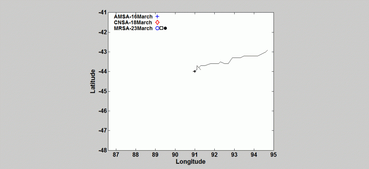
By using ocean modelling techniques the researchers have back-tracked and forward-tracked floating objects identified by the Australian Maritime Safety Authority (AMSA), the China National Space Administration (CNSA) and Malaysian Remote Sensing Agency (MRSA) satellites on 16, 18 and 23 March (see videos below). These objects have yet to be confirmed debris from flight Malaysian Airlines flight MH370.
Search for the black box:
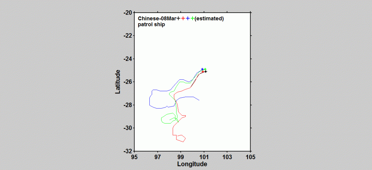
Video 6 shows forward tracking of four arbitrary floating objects 10km apart at the location where Chinese patrol ship Haixun01 detected a pulse signal of the same frequency as that used by black boxes on 5 April.
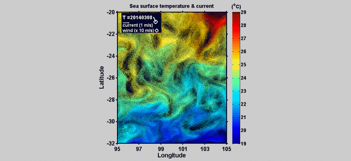
Video 7 shows the current and eddy patterns from 8 March to 12 April. Daily wind speed and direction is denoted at the top left corner.
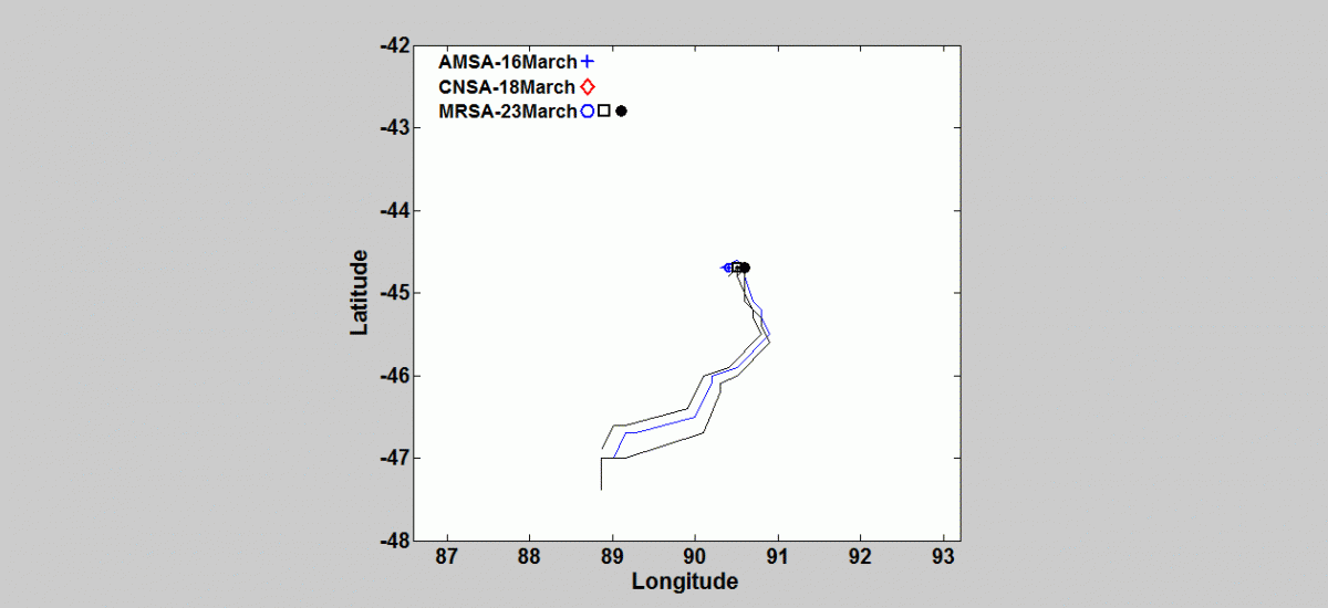
Video 1 shows debris identified on 16, 18, 23 March backtracking to 8 March.
UNSW Canberra researchers’ analysis concludes:
- UNSW Canberra Oceanographers are able to backtrack and forward track identified floating objects to their original and future locations.
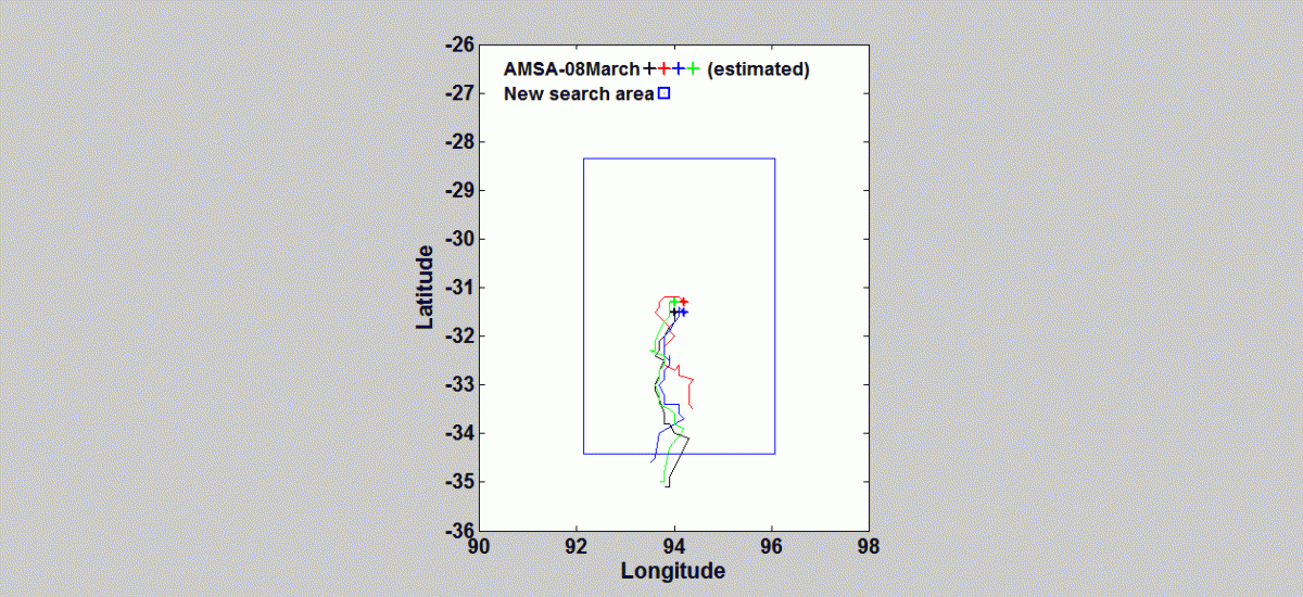
- Their findings show that two of the three MRSA objects identified on 23 March seem to originate from same location (46.96˚S, 88.92˚E).
- The AMSA objects and the most southern MRSA objects were around 200 km apart on 8 March, indicating the AMSA object may not be related to the MRSA objects.
- The objects identified by AMSA on 16 March appears to be moving the fastest, with a maximum speed of 14 kilometres per day, or 0.16 metres per second with a different direction to those of the other objects for the period from 8 March to 1 April. This variability is caused by strong currents and eddy activities in the region (see the attached third movie), thus the search efforts by the aircraft and ships need to consider this variability.
Researchers are now calculating the movement of new objects identified since the 23 March.
Once any debris is formally identified as coming from MH370, the application of this modelling to that debris is likely to identify the crash site zone within a 10 km radius.
Video 2 shows forward tracking of the debris identified on 16, 18, 23 March to 5 April.
Particle tracking is an ocean modelling technique used to find the starting and finishing position of a passive particle in the model using currents forecasted by a high-resolution Ocean General Circulation Model (OGCM). In this case the daily averaged surface current data from BLUElink is used. BLUElink provides 3-dimensional ocean variables including velocity and water temperature fields with a grid resolution approximately 10km in the Southern Ocean.
UNSW Canberra Oceanographers have used this modelling to sucessfully track sediment movement in Shanghai Port, Darwin Harbour and Jervis Bay. They have also used the modelling to study water circulation in the Adriatic Sea.
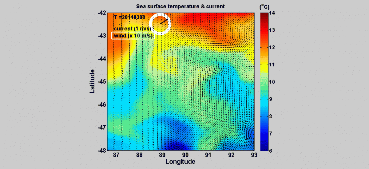
Video 3 shows the current and eddy patterns from 8 March to 5 April. Daily wind speed and direction is denoted at the top left corner.
New Search Area from 28 March:
Video 4 shows forward tracking of four arbitrary floating objects identified on 8 March to 5 April.
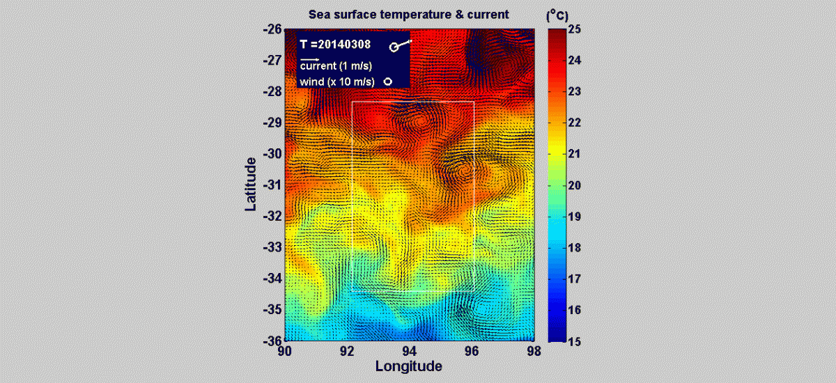
Video 5 shows the current and eddy patterns from 8 March to 5 April. Daily wind speed and direction is denoted at the top left corner.
For further information email h.wang@adfa.edu.au